Plan3D: Viewpoint and Trajectory Optimization for Aerial Multi-View Stereo Reconstruction
1ETH Zurich 2Technical University of Munich
ACM Transactions on Graphics 2018 (TOG)
Abstract
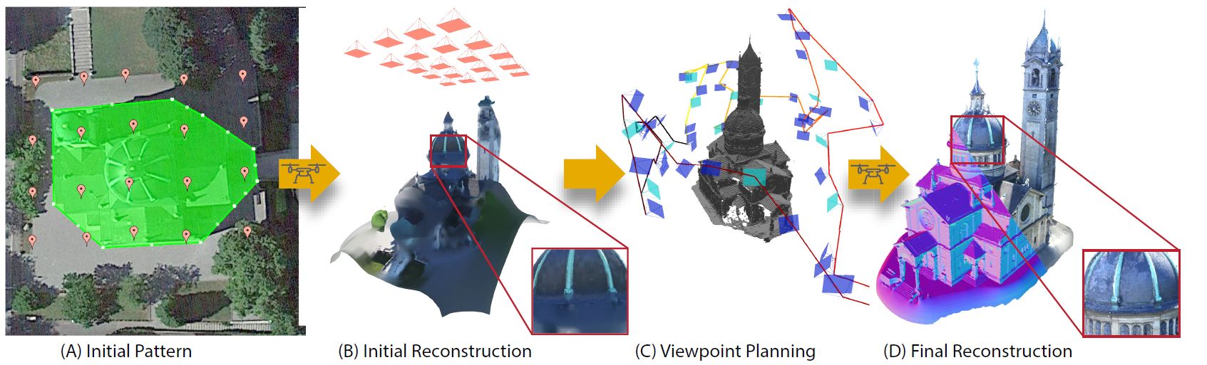
We introduce a new method that efficiently computes a set of viewpoints and trajectories for high-quality 3D reconstructions in outdoor environments. Our goal is to automatically explore an unknown area, and obtain a complete 3D scan of a region of interest (e.g., a large building). Images from a commodity RGB camera, mounted on an autonomously navigated quadcopter, are fed into a multi-view stereo reconstruction pipeline that produces high-quality results but is computationally expensive. In this setting, the scanning result is constrained by the restricted fight time of quadcopters. To this end, we introduce a novel optimization strategy that respects these constraints by maximizing the information gain from sparsely-sampled view points while limiting the total travel distance of the quadcopter. At the core of our method lies a hierarchical volumetric representation that allows the algorithm to distinguish between unknown, free, and occupied space. Furthermore, our information gain based formulation leverages this representation to handle occlusions in an efficient manner. In addition to the surface geometry, we utilize the free-space information to avoid obstacles and determine collision-free fight paths. Our tool can be used to specify the region of interest and to plan trajectories. We demonstrate our method by obtaining a number of compelling 3D reconstructions, and provide a thorough quantitative evaluation showing improvement over previous state-of-the-art and regular patterns.
 Bibtex